
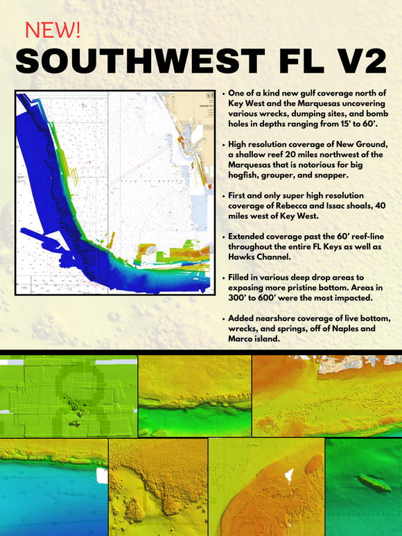
SOUTH WEST FLORIDA V2 3D RELIEF SHADING CMOR CARD
The South West Florida V2 3D Relief Shading CMOR Mapping Card now includes:
-
Over 500 square miles around the Marquesas with depths ranging from 1' in the Quicksand's to 600' in the deep holes south of the Marquesas reef.
-
4,076 square miles in the Florida Canyons with depths ranging from 1,000' in red to 11,200' in purple.
-
300 square miles to the East, West, and North of the Dry Tortugas with depths ranging from 35' in red to 890' in purple.
-
150 square miles covering Pulley Ridge and the surrounding grounds to the west / southwest from 130’ to 600’
-
Untouched muddy bottom west of the Dry Tortugas for tilefish out in 490', deeper structure in 850' that holds queen snapper and deep water grouper, and shallow coral heads and ledges for lobster and monster hogfish!
-
Full shallow reef coverage from 10’ to 35’ south of Big Pine Key extending past the Marquesas. Great for spearfishing and lobstering!
-
Extensive coverage of gulf wrecks and dumping grounds north of Key West and the Marquesas ranging in depth from 15’ to 60’.
-
Nearshore Coverage of live bottom and springs out of Naples and Marco island.
All CMOR Cards with the exception of Furuno are provided on Micro SD cards with a standard SD adapter included.
Furuno customers: Instead of a physical card, you will receive an unlock code to access CMOR imagery on your device. Your NavNet system ID is required in order to generate the unlock code. Also, please note that South West Florida V2 is not yet available for Furuno is it is in the processing stage.
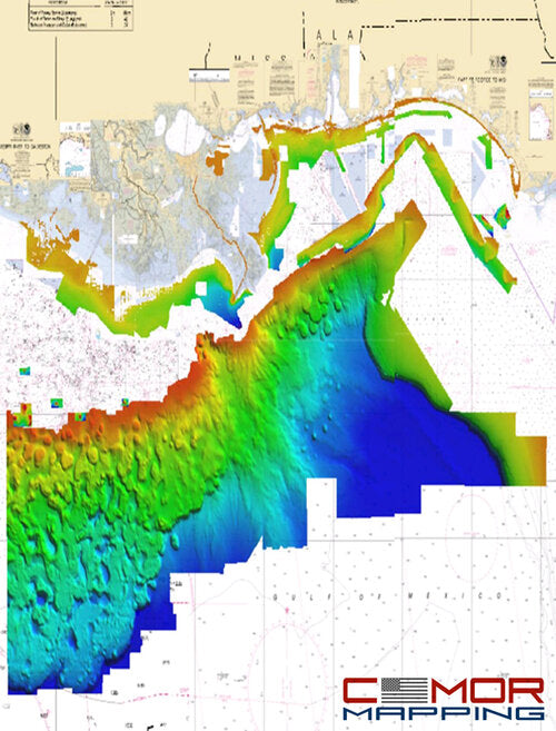
COVERAGE DETAILS
Covered areas include:
-
434 square miles around the Marquesas with depths ranging from 1' in the Quicksands to 330' in the deep holes south of the Marquesas Rock
-
4,076 square miles in the Florida Canyons area with depths ranging from 1,000' in red to 11,200' in purple
-
250 square miles on the west side of Dry Tortugas with depths ranging from 35' in red to 890' in purple
-
150 square miles covering Pulley Ridge and the surrounding grounds to the west from 130’ to 500’.
-
The Florida Canyons running up to the shallower areas and the nice structure on the flat areas in 2,000'.
-
Nice muddy bottom west of the Dry Tortugas for tilefish out in 490', deeper structure in 850' that holds queen snapper and deep water grouper, and shallow coral heads and ledges for lobster and monster hogfish!
Please note that there are several areas in the Tortugas where anchoring, spearfishing and entering are prohibited so check the regulations prior to arrival.
NOAA Charts 11439 and 11013 are included in the background.
![Fusion MS-RA210 Stereo w/AM/FM/BT/SiriusXM - 2 Zones w/DSP [010-02250-00]](http://elcapitan.com/cdn/shop/files/81126XL_{width}x.jpg?v=1683416203)
![Fusion MS-RA210 Stereo w/AM/FM/BT/SiriusXM - 2 Zones w/DSP [010-02250-00]](http://elcapitan.com/cdn/shop/files/81126XL_580x.jpg?v=1683416203)


![Fusion Apollo Marine 6 Channel 1800-Watt Amplifier [010-02284-65]](http://elcapitan.com/cdn/shop/files/100702XL_{width}x.jpg?v=1692811110)
![Fusion Apollo Marine 6 Channel 1800-Watt Amplifier [010-02284-65]](http://elcapitan.com/cdn/shop/files/100702XL_580x.jpg?v=1692811110)
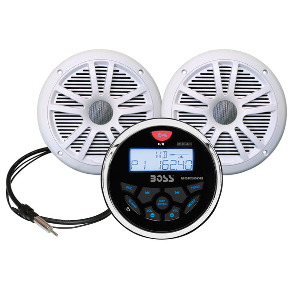
![Boss Audio MCKGB350W.6 Marine Stereo 6.5" Speaker Kit - White [MCKGB350W.6]](http://elcapitan.com/cdn/shop/files/54603XL_{width}x.jpg?v=1683372667)